Hotel and travel plans

Local map
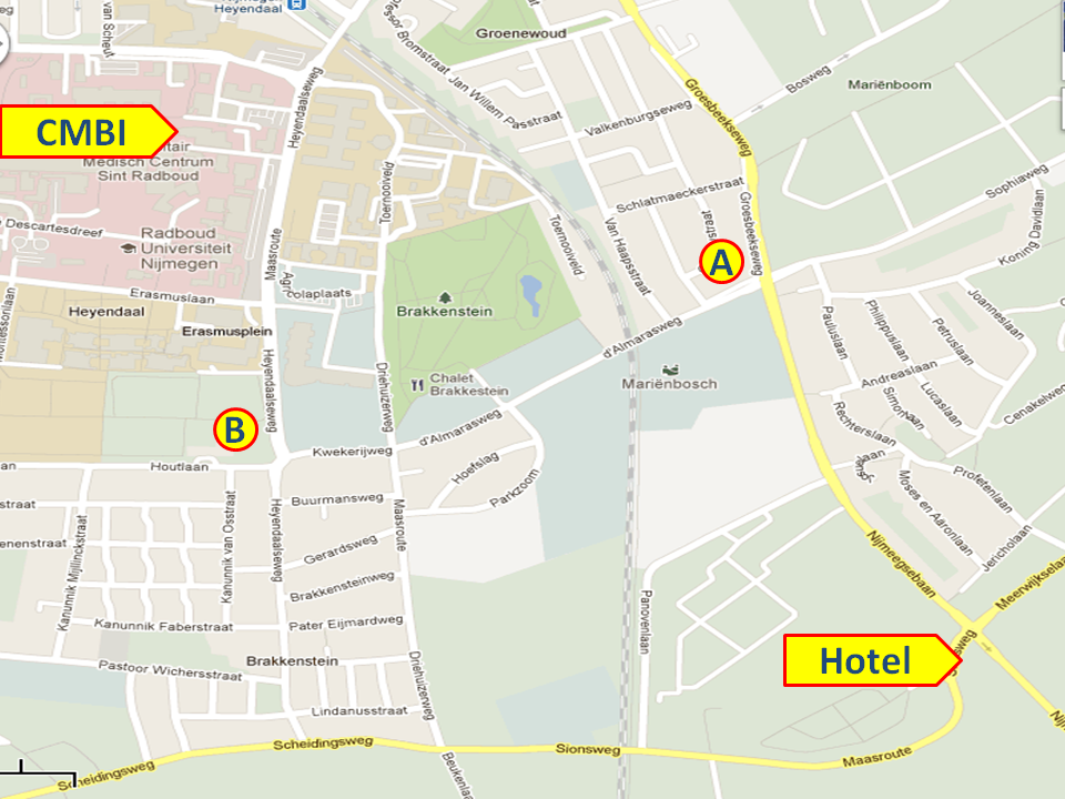
In the map inserted below, you see indicated the hotel (Sionshof) and the CMBI where the meeting is.
Both when walking (20 minutes) and when driving a car (5 minutes), it seems best to go via the
two intersections that I labeled A and B. At A you find traffic lights, and at B you are,
coming from the hotel and going towards the CMBI, at a T-shaped intersection with our sports
facilities at your right-hand side. The route direct from the hotel to B is blocked by the rail-road.
The route through parc Brakkenstein loks shorter on the map, but is not easy to do in practice because
of fences, and big buildings that block your way.


